
At the Boundary of Impermanence

Photos by Pat Greenfield
Project: At the Boundary of Impermanence
Exhibition: Impermanence: The Tongapōrutu Coastline — A 20 Year Odyssey
Location: Puke Ariki Museum, New Plymouth, Aotearoa New Zealand
Dates: 20 May 2022 – 27 November 2022
Role: Digital exhibition development, StoryMaps production, digital coordination, content structuring, interactive mapping, image preparation, online interpretation
Artist collaborator: Pat Greenfield
Media: ArcGIS StoryMap, interactive map, video, digitised unpublished book, hand-drawn maps, before-and-after photography sliders, QR-linked exhibition content
Recognition: Second place, 2022 New Zealand StoryMaps competition
Tools / Methods: ArcGIS StoryMaps, digital imaging, JavaScript before-and-after sliders, interactive mapping, video integration, digitisation, online exhibition design
Award-winning StoryMaps digital exhibition developed with artist Pat Greenfield, combining biography, video, interactive mapping, archival photography, before-and-after comparisons, and a digitised unpublished book documenting 20 years of coastal erosion at Tongapōrutu.
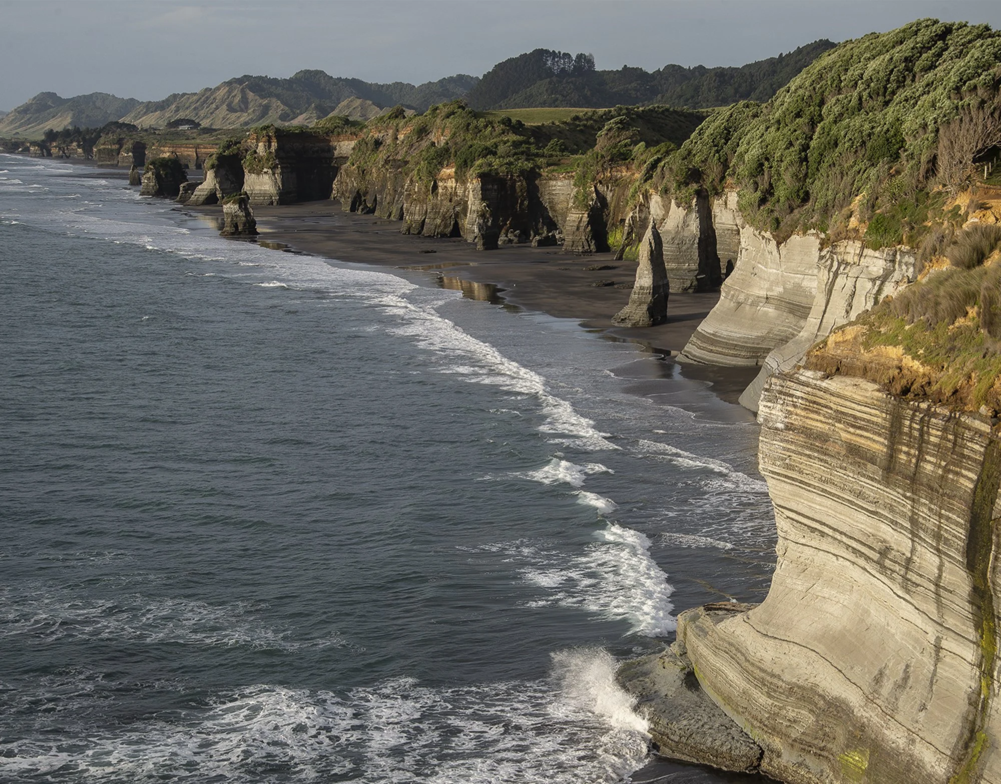
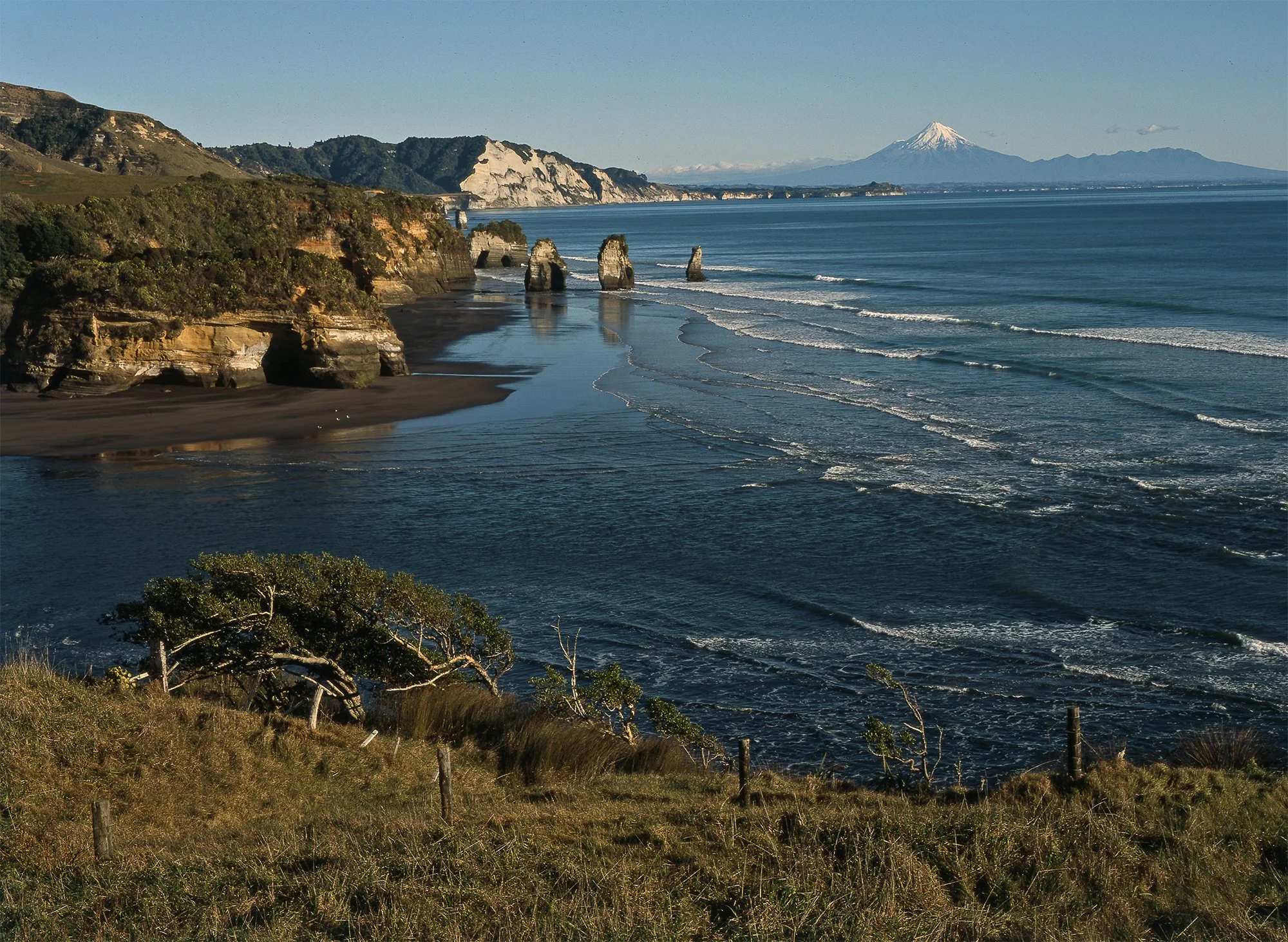
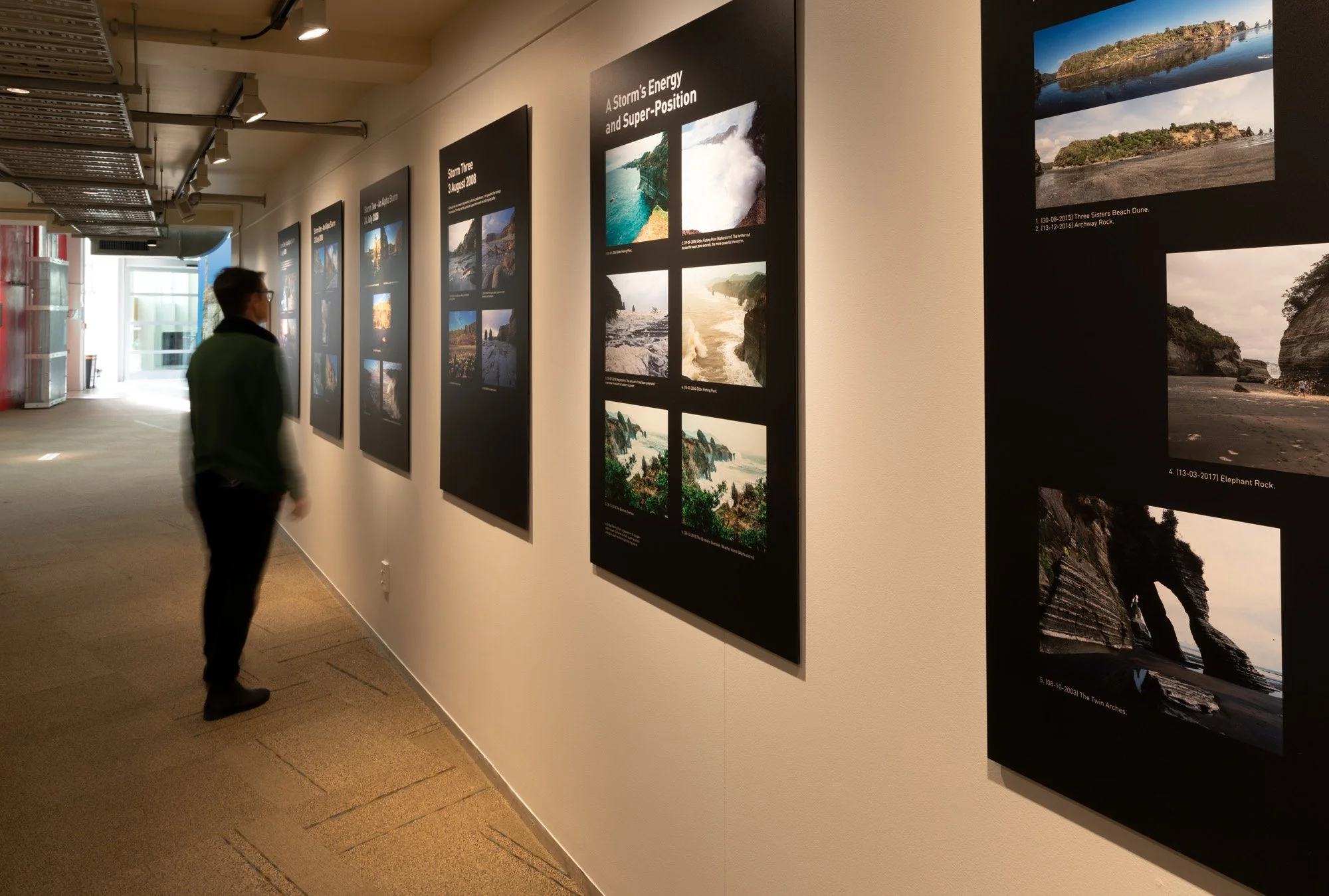
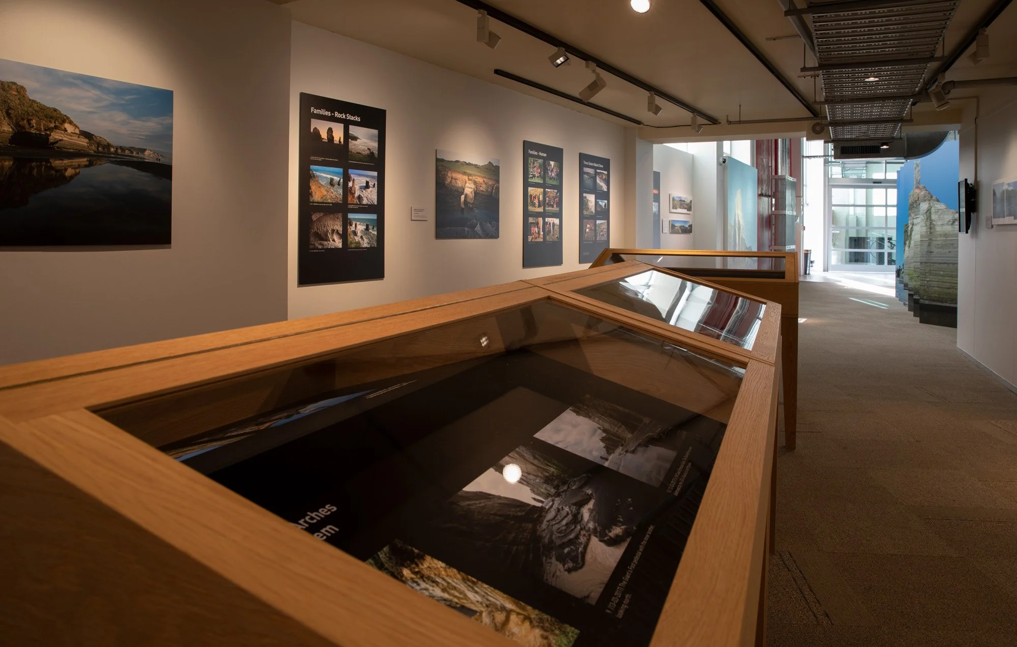
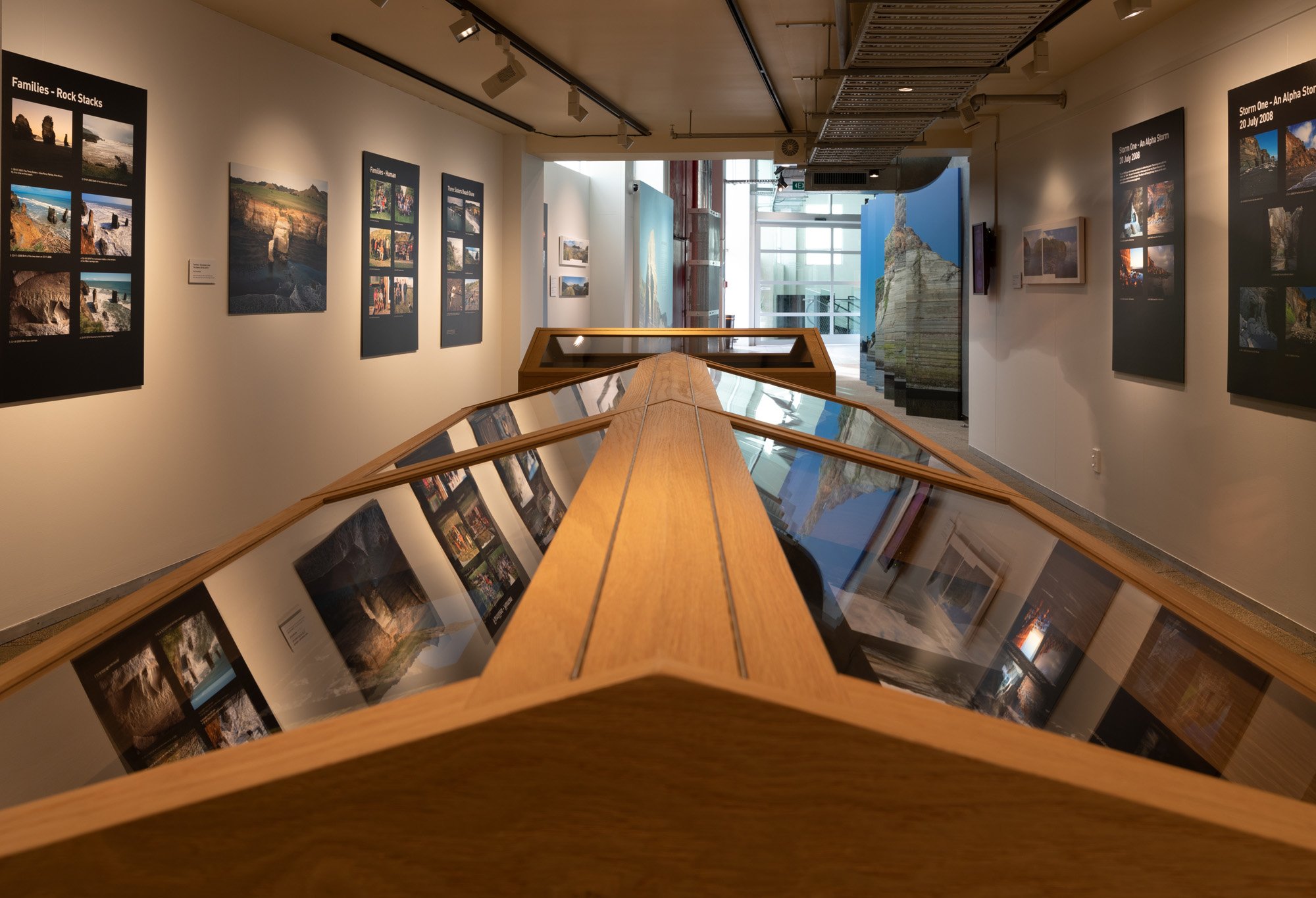
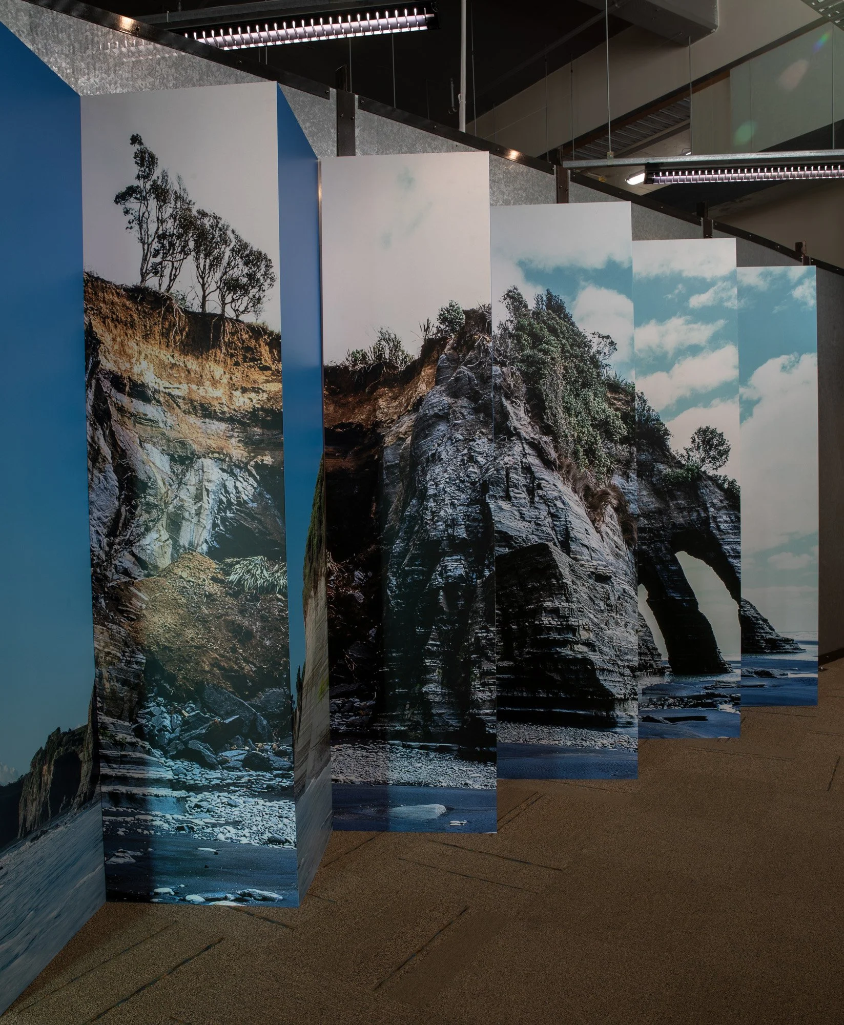
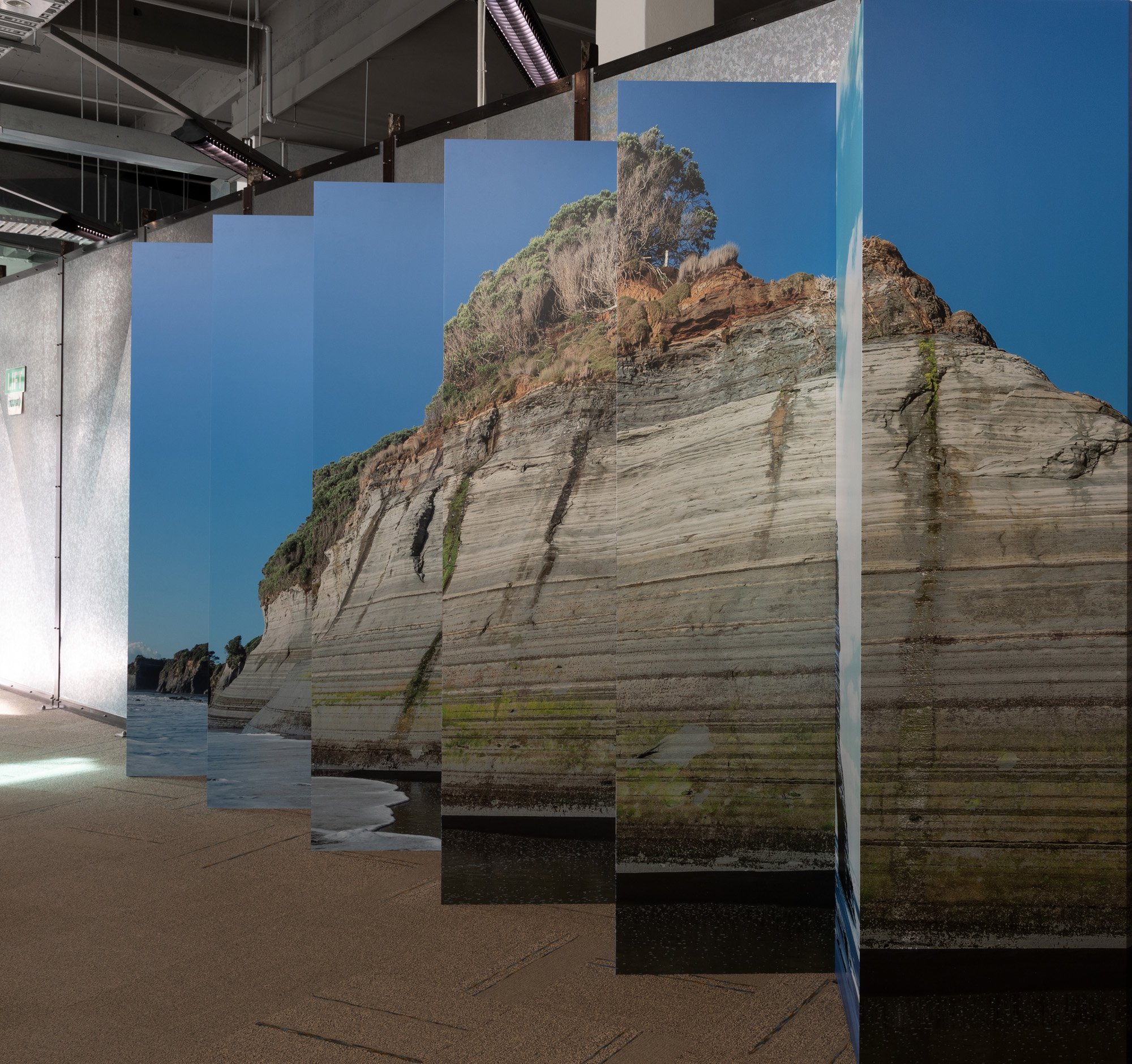
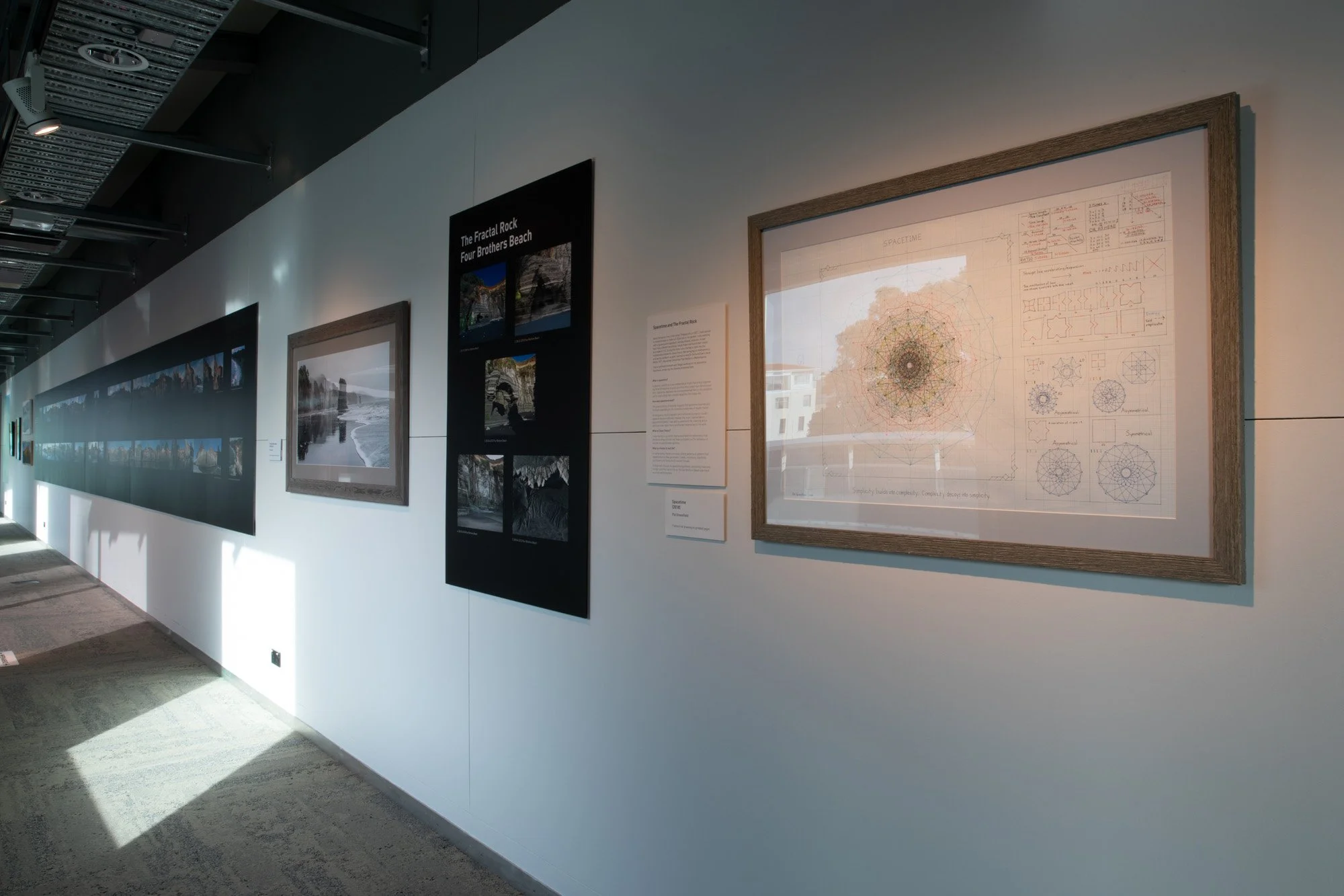
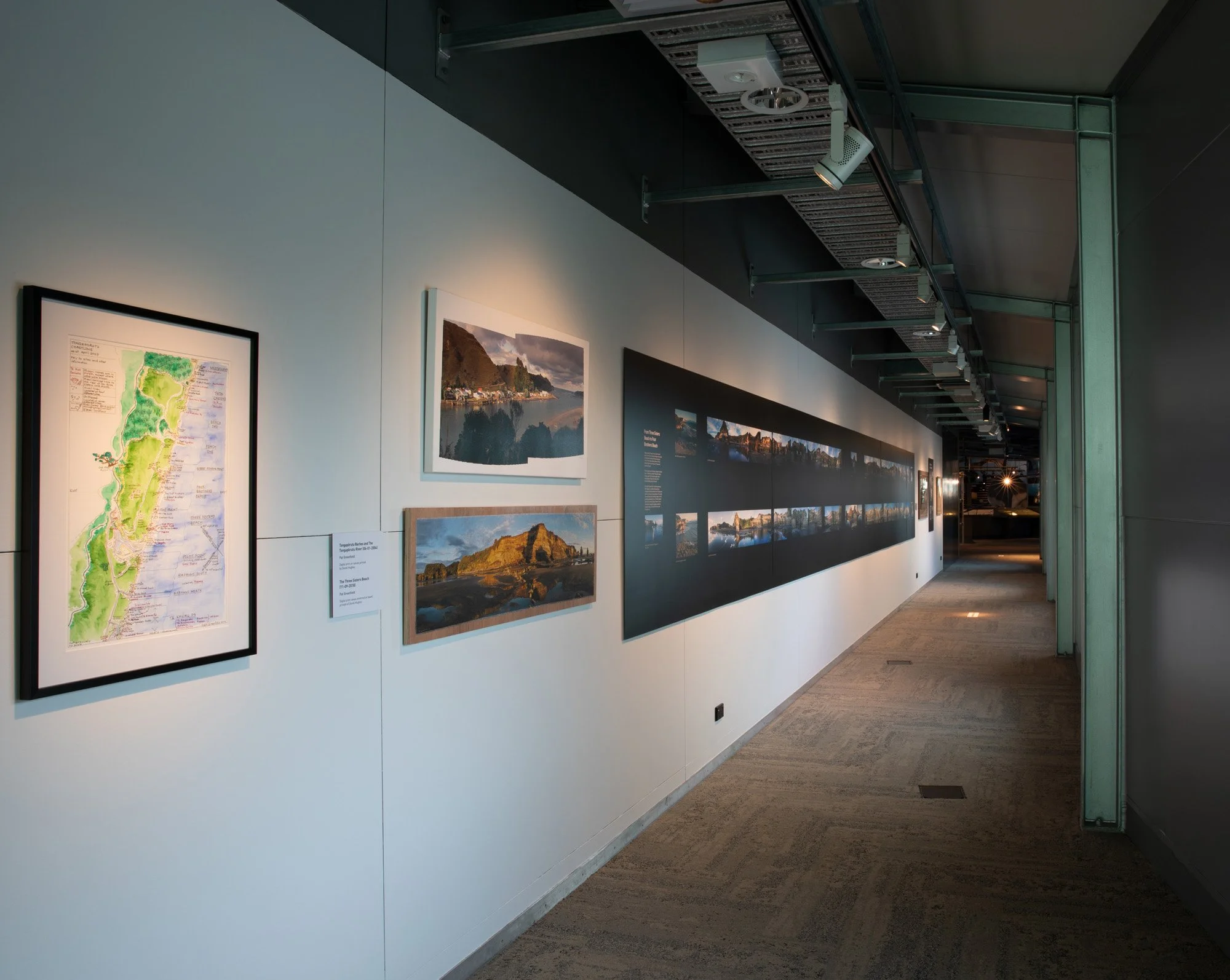
Impermanence: The Tongapōrutu Coastline — A 20 Year Odyssey presented the work of Taranaki-based photographer and self-described archivist Pat Greenfield, who spent two decades documenting erosion and environmental change along the Tongapōrutu coastline. The exhibition focused on Three Sisters Beach, Four Brothers Beach, the region’s cave systems, and the dramatic white cliffs of north Taranaki, a coastline described by Puke Ariki as one of the fastest-eroding in the world. The exhibition ran at Puke Ariki from 20 May to 27 November 2022.
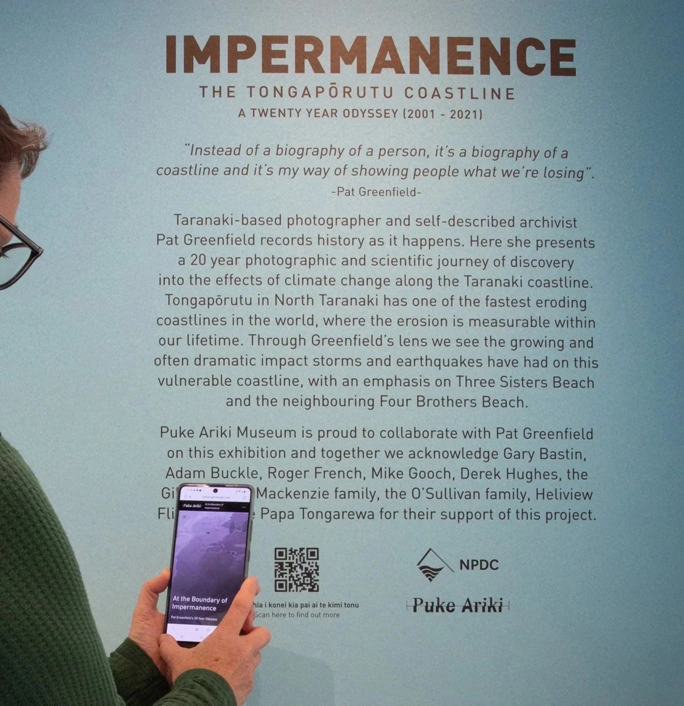
Photo by Rosie Moyes
As part of the exhibition, I developed At the Boundary of Impermanence, an interactive online StoryMaps exhibition created in collaboration with Pat Greenfield. The digital project expanded the physical exhibition by bringing together Pat’s biography, interviews, photographic records, hand-drawn maps, erosion research, and unpublished writing into a navigable online experience. The story map was linked from the exhibition through QR codes and remained accessible beyond the gallery as a lasting digital resource.
A major focus of the project was translating Pat’s 20-year photographic journey into an interactive structure. I worked with her material to build an online map of the Tongapōrutu coast, allowing audiences to move through the places she had documented over time. The story map connected locations, images, video, written interpretation, and research notes, creating a digital pathway along the coastline and making the scale of her long-term documentation easier to understand.
The project also included a significant digitisation and publishing component. Pat’s unpublished book, At the Boundary of Impermanence, was digitised and shared with the public through the story map for the first time. This allowed material that had previously existed outside public access to become part of the exhibition’s digital interpretation, connecting her artistic, archival, and observational work in one place.
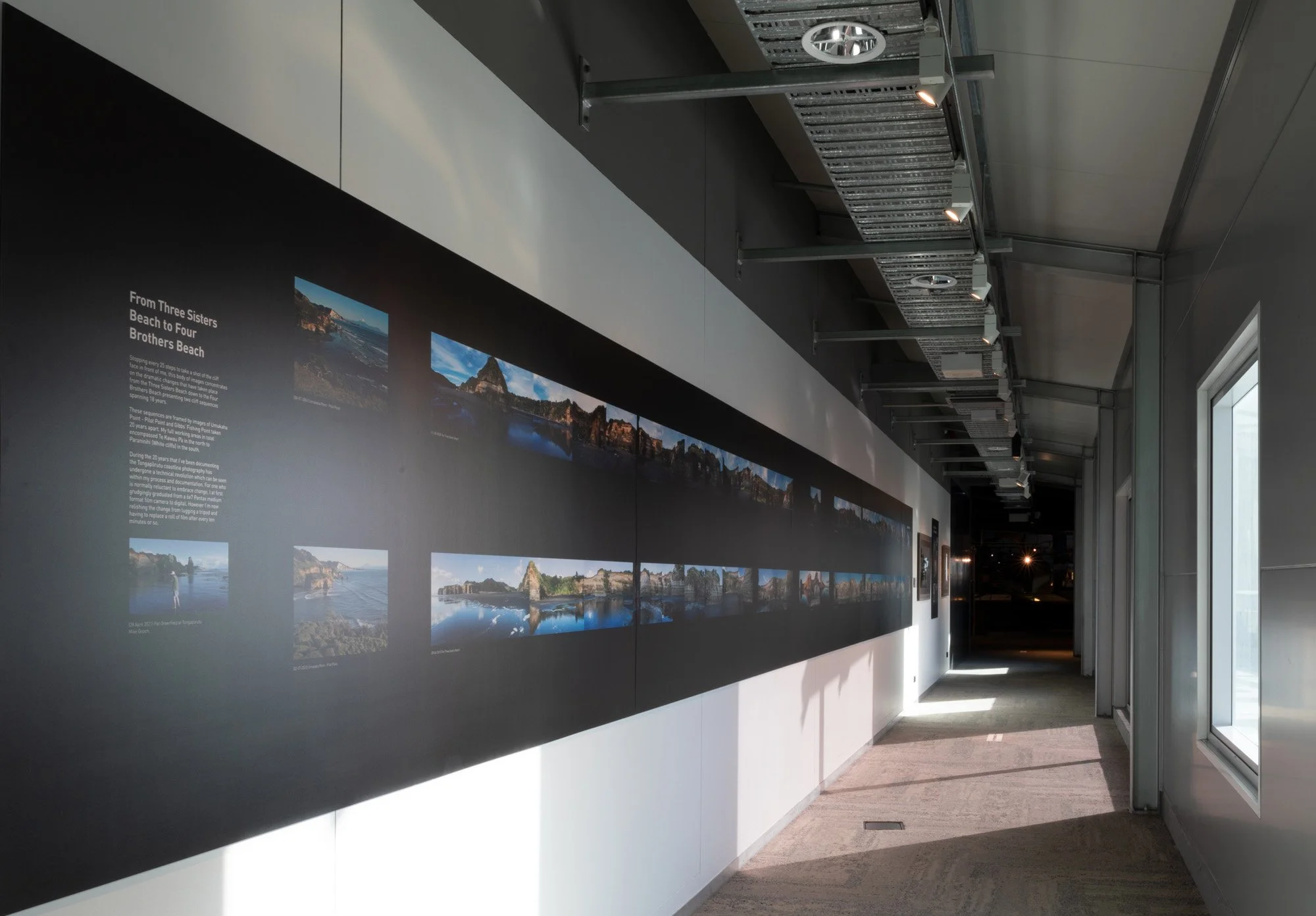
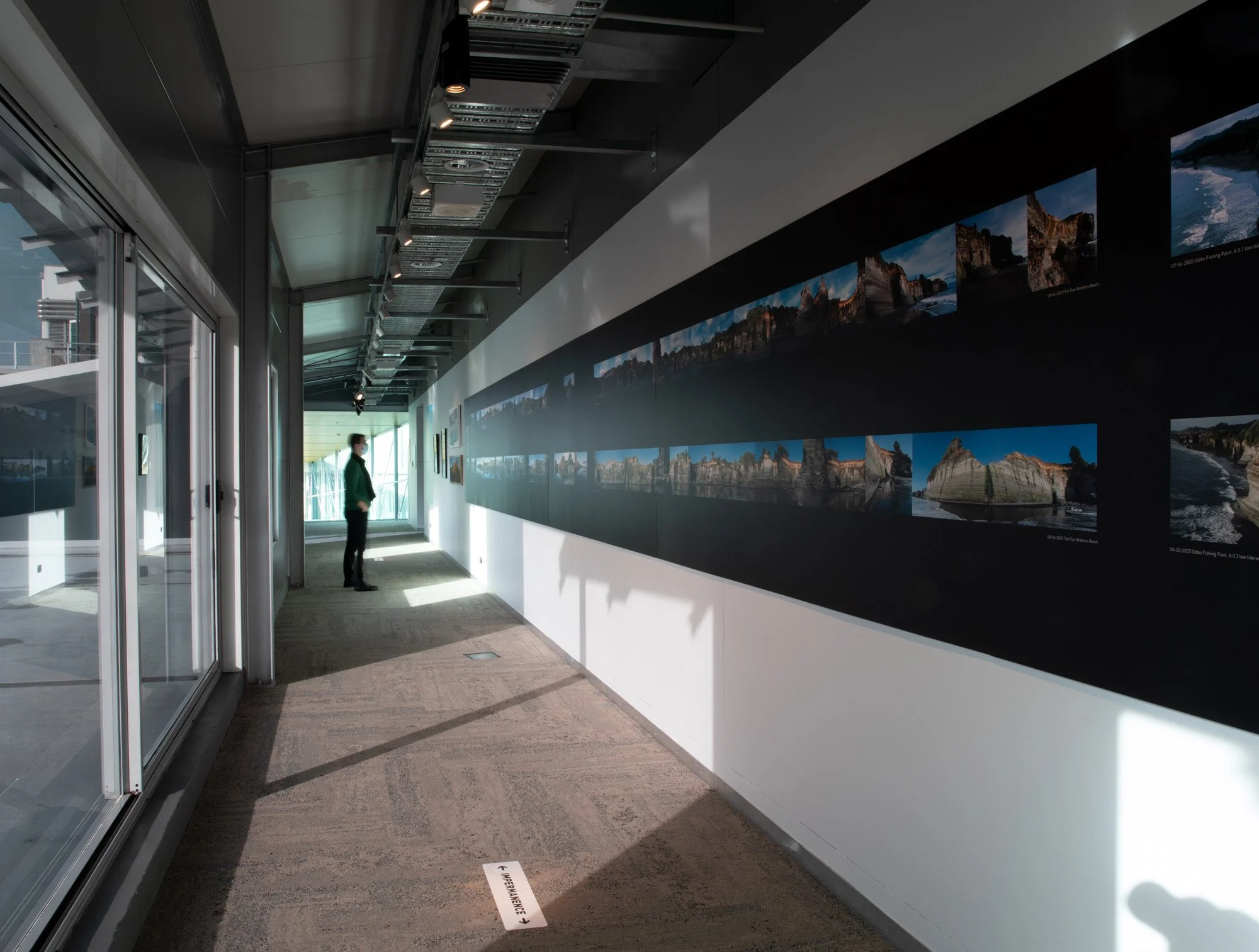
One of the strongest interactive elements was a series of before-and-after image comparisons. Using photographs Pat had taken from the same locations across many years, I built JavaScript slider interactions that allowed viewers to compare changes in the coastline directly. These sliders made the effects of erosion visible and immediate, turning long-term environmental change into something visitors could explore through direct visual comparison.
The story map also included video, biographical material, hand-drawn maps, and explanations of Pat’s theories and observations about erosion along the coastline. The aim was not simply to document the physical exhibition, but to create a digital companion that could hold more complexity, more context, and more of the artist’s long-term process than the gallery space alone could accommodate.
Tongapōrutu Coastline – aid to navigation map (2010). Pat Greenfield. Collection of Puke Ariki(PHO2008-361)
Manuscript, At the Boundary of Impermanence. Rosie Moyes (2022), Digital photo.
The result was an award-winning digital exhibition that extended the reach and depth of Impermanence. The StoryMaps project was submitted by New Plymouth District Council’s GIS team to the Eagle Technology / ArcGIS StoryMaps competition and won second place in the 2022 New Zealand StoryMaps competition. This recognition reflected both the quality of Pat Greenfield’s material and the strength of the digital structure built around it.
This project demonstrates my approach to digital exhibition development: using online tools to deepen interpretation, preserve artist process, support public access, and create meaningful interactive experiences from complex visual and archival material. It also shows how a digital exhibition can function as more than a supplement, becoming an enduring public resource in its own right.